CAPE REINGA, THE SPIRIT OF NEW ZEALAND
Some journeys take you somewhere; others slowly distance you from everything you know. The road to the far north of New Zealand is one of these. We leave Auckland with a full tank and the familiar feeling that a journey begins when you leave the city behind. Except this time, the city doesn't disappear immediately.

It clings to us for a long time: motorways, petrol stations, traffic lights, suburbs, shops, trucks, houses following one another without interruption. In the rear-view mirror, Auckland gradually grows smaller, but its world still travels with us.

It clings to us for a long time: motorways, petrol stations, traffic lights, suburbs, shops, trucks, houses following one another without interruption. In the rear-view mirror, Auckland gradually grows smaller, but its world still travels with us.

Paihia – The Last Holiday Before the North
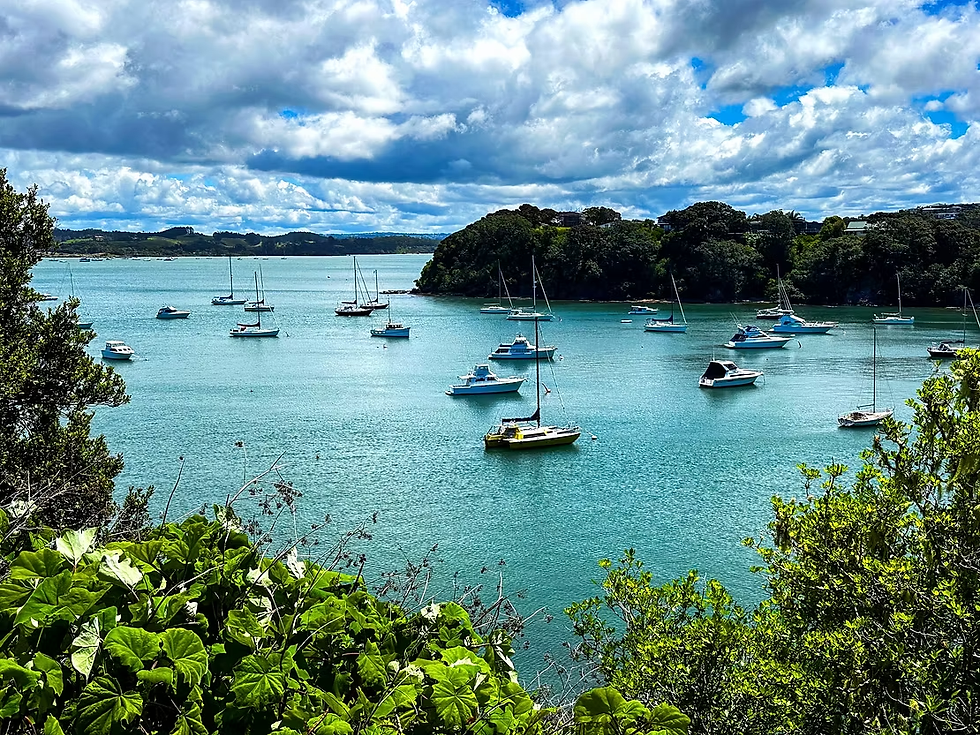
The first real stop is Paihia, a town that seems to have been built specifically for holidays. Boats rocking gently in the bay, tourists with cameras, cafés, restaurants, souvenir shops, and people strolling without a care, as if time had been invented just for them. The Bay of Islands is one of New Zealand’s great tourist destinations, and Paihia naturally embraces its role as the gateway to this paradise.

We stop for a coffee and a short walk along the waterfront. It is still a familiar world. A world where you can buy almost anything, eat almost anything, and always find someone to tell you where to go. But we keep moving. And somewhere, without noticing the exact moment, the holiday begins to turn into a journey. After this long drive, we check in, leave the weariness of the day behind, and wait for the following morning.

We are not far from our destination now, but it is precisely this anticipation that gives the journey a special atmosphere. The next day, we will set out for a place that New Zealanders regard as the country’s most spiritual, a land where Māori mythology, the ocean and the earth seem to meet at the edge of the world. Where the road ends, perhaps another journey begins.

Kerikeri – The Land of Oranges
The road takes us to Kerikeri, one of the most pleasant towns in Northland. Here, the north still has a generous and cultivated face. Orchards, fruit trees, gardens, small farms, and shops where local produce still seems to have a direct connection with the land behind it.
Kerikeri is also the land of oranges. We stop for a few minutes. We do not need a spectacular attraction. Sometimes it is enough to buy something to eat, sit on a bench and watch people passing by. The journey does not need to be rushed. We are beginning to understand that the north is not something to be conquered. It is crossed slowly.

State Highway 10 – The Road Begins to Empty Out
From Kerikeri we join State Highway 10. At first, not much changes. The road is good; cars still appear, and there are plenty of signs. But gradually, the traffic thins out. Towns become villages. Villages become a few houses. And a few houses sometimes become nothing more than a name on a map.

We pass through Orotēre without needing to turn the place into a tourist destination. We stop for a few minutes somewhere quiet, stretch our legs, and take in the scenery. It is one of those stops you will not find in tourist brochures. And that is precisely why they stay in your memory.
Kaeo – The Real North Begins Here
In Kaeo, the atmosphere is already different. We are no longer in the world of hotels and organised tours. It is a small, rural town, surrounded by hills and water, with a rhythm of its own. We stop, buy a coffee, and walk around for a few minutes. Here, we begin to sense what we have been looking for. The real Northland is not necessarily the one found in tourist photographs. It is the Northland of the people who live here, of farms, back roads, small shops, and a way of life that does not need tourists to exist. The road continues.

Mangonui and Paewhenua Island
Mangonui appears almost as a surprise. After kilometres of road and hills, the sea opens up before us once again. The old houses, harbour, boats and wooden buildings give the place a distinctive atmosphere. We park and walk along the waterfront. Here, there is no need to hurry. We look out over the water and imagine how many generations have looked upon it before us. Merchant ships, fishermen, Māori, settlers, travellers. The sea keeps no photographs, but it keeps memory. And we are merely another pair of eyes looking out at it.

After Mangonui, the road takes us across Paewhenua Island. For a few minutes, we have the impression that the road was laid between water and sky simply to remind us that land is never permanent. We slow down. Not because we have to. Because we want to. Water stretches out on either side, and the road seems to float. It is one of the first symbolic crossings of the journey: once we have crossed the island, the North seems a little further removed from the world we left behind.

Coopers Beach and Cable Bay – A Break by the Ocean
We reach Coopers Beach and make a longer stop at Cable Bay Beach. This is the moment when we completely leave the car behind. We walk along the beach. The sand, the water, the wind, and the endless line of the horizon force us to slow down.
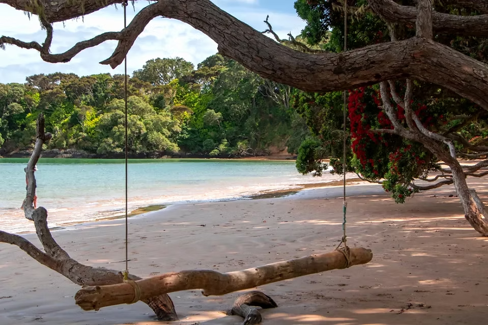
We sit down for a few minutes. We do nothing. And that is precisely the point of the stop. Sometimes, on a long journey, the most important destination is a bench where you sit for ten minutes without thinking about anything.

Taipa – The World Still Exists
Taipa welcomes us with the same quiet coastal air. Holiday homes, bays, vegetation and people who seem to have learned a lesson that we, city dwellers, constantly forget: there is no need to hurry. But the North is calling us onwards. We get back into the car.

Kaingaroa and Awanui
At Kaingaroa, the landscape begins to change. There are no longer as many tourists around. The settlements are more understated. The roads seem longer, and the distance between people and places grows. We make a brief stop. There is nothing spectacular about it. And that is precisely its beauty. Here, you begin to see another New Zealand: one that has not been arranged for photographs.

In Awanui, we reach one of the important crossroads of the journey. From here on, the direction is clear. North. We join New Zealand Highway 1 – Far North Road. Until now, we have been travelling north. From here on, we head for the very end.
Pukenui and Houhora
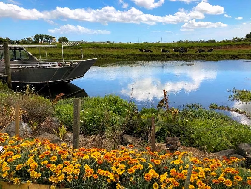
Pukenui already seems detached from the rest of the country. We make a brief stop. A coffee, perhaps something to eat, a few minutes spent looking at the road ahead. Then we leave. The landscape becomes more expansive. The wind feels different here. And you begin to understand that what we call the “Far North” is not merely an administrative region. It is a state of mind.
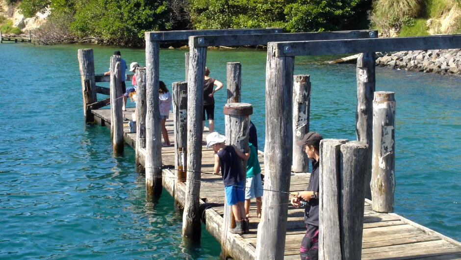
At Houhora, the sea appears again. Northland seems to be constantly playing with its shapes: peninsulas, bays, estuaries, islands, beaches, and roads that wind their way between them. We stop for a few minutes and look out across the water. It is impossible not to think about how small the road we are travelling on is compared with the vastness of the ocean. And perhaps this is the first moment when the human presence begins to disappear from the landscape.

Ngataki and Te Kao
In Ngataki, the north becomes almost silent. The car moves steadily forward, and the kilometres slip by. Houses are few and far between. People are even rarer. We begin to stop looking for attractions. We are simply looking for the next kilometre. And, paradoxically, the journey becomes more interesting.

Te Kao is one of the last significant stops. Here, you can feel that something has changed. Not just the geography. We have changed too. We left Auckland with the reflexes of the city still active. Now we no longer need them. The phone can stay in the pocket. The schedule no longer matters. There are no meetings, traffic lights, or rush anymore. There is only the road. And the north.

Tangoake and Karatia – the last signs of civilisation
We pass through Tangoake and then Karatia. These are places we might once have driven past without even remembering their names. Now every sign seems important. Every house. Every bend. Every kilometre. Because we know we are getting closer. The road becomes a story.

Waitiki – the last petrol station
And then we reach Waitiki. The last petrol station before Cape Reinga. There are about thirty kilometres to go. We stop. We fill the tank. We buy a coffee and something to eat for the final kilometres. We stretch our legs and look around. There is nothing grand about the place. And yet, it has something solemn about it. Because we know that from here on, we need almost nothing else. The last petrol station. The last coffee. The last stop. Beyond it, there is only the road. And the end of the road.

The Final Thirty Kilometres
We set off again. As we move forward, you can feel that everything that has accompanied us since Auckland has been left somewhere behind. The cities. The shops. The traffic. The noise. The rush. Even the feeling that we have to get somewhere. The road stretches out before us, and the landscape seems to open up more and more. The sky becomes more important. The wind becomes more important. The ocean becomes more important. We become smaller. And perhaps, for the first time on this journey, we no longer feel that we are going somewhere. We feel that we are already there.

The Passage into the Spiritual
Having arrived here, at the northernmost end, the road begins to take on a different meaning. Until now, we have measured the journey in kilometres: Auckland, Paihia, Kerikeri, Mangonui, Awanui, Pukenui, Te Kao, Waitiki. We have filled the car with fuel, had coffee, stretched our legs on beaches, and continued ever northward. But from here on, it is no longer about kilometres. We have arrived at a place where, for Māori, the world of the living and the world of spirits draw close to one another.

Te Rerenga Wairua — “the place where the spirits depart” — is one of the most sacred places in Aotearoa. According to tradition, after death, the wairua, the human spirit, sets out towards the north, following a spiritual pathway known as Te Ara Wairua, all the way to the end of the land. And looking at the landscape, you understand why such a place could have become the centre of such a story.

90 Mile Beach – the pathway of the spirits
Before Cape Reinga stretches Te Oneroa-a-Tōhē, known in the tourist world as Ninety Mile Beach. The English name is, in fact, a small geographical deception: the beach is approximately 88 kilometres long, not 90 miles. But in our imagination, the numbers have become more important than the measurements. For Māori, however, this vast stretch of sand is much more than a spectacular landscape.

Tradition describes the west coast as part of the path followed by spirits on their journey towards Te Rerenga Wairua. The spirit travels north, waits for the right moment in the tide, and continues towards the place of departure. Thus, what is “90 Mile Beach” to a tourist becomes, in the Māori imagination, a highway of spirits. We stand on the sand for a while. The ocean is immense. It no longer feels like a beach at all. It feels like a road.

The Bay of Spirits
On the north-eastern coast, we come across Piwhane/Spirits Bay, a wide, isolated bay surrounded by dunes and vegetation. The English name seems almost too fitting. But here the Māori name is essential: Piwhane. According to tradition, the pathway of the spirits passes through this region before reaching the end of the peninsula. From Spirits Bay, the spiritual journey continues towards the Cape Reinga area.

Today, the Te Paki Coastal Track follows this coastline, linking Spirits Bay with Pandora and then continuing towards Tapotupotu and Cape Reinga. We stop. Not much is needed. A bay, the wind, and the ocean are enough. Here, you begin to understand that the landscape is not merely the setting of a story. The landscape is the story.
Twilight Beach – the beach at the end of the world
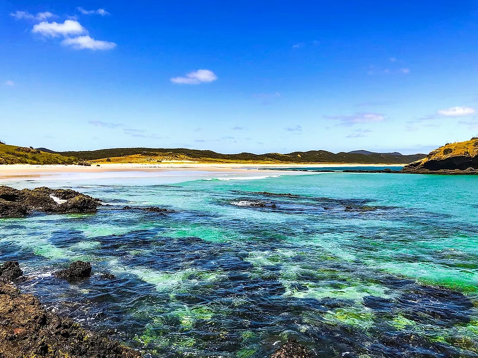
Further on, Paengarehia/Twilight Beach comes into view. The English name seems almost a perfect fit. The light here can transform the beach into a film scene: the long stretch of sand, the dunes, the ocean, and the low vegetation battered by the wind.

And even though this has nothing to do with Bella Swan and Edward Cullen, with vampires, werewolves, and teenagers in love staring dramatically at one another through the forest, Twilight Beach seems to have descended from another mythology. There is something unreal about its light, the deserted sand, the dunes rising towards the sky, and the ocean stretching beyond the horizon.

The name seems anything but accidental. It is a place with a distinctive light, an air charged with mystery, where you get the feeling that nature itself preserved an ancient magic here, long before Hollywood discovered that twilight could be romantic, dangerous, and highly profitable. It is one of those beaches that makes you feel as though a director had asked the film crew to create “something truly wild.” Except that nobody built anything. Nature did it all.
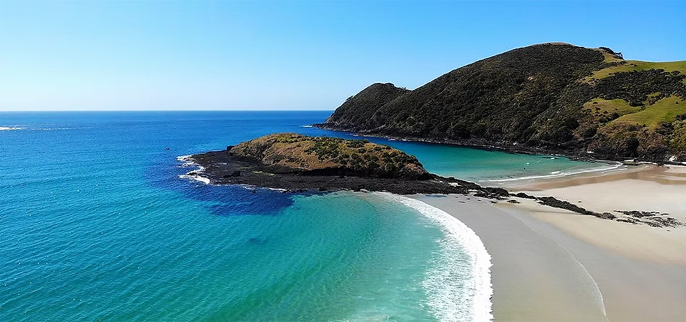
The Te Paki Coastal Track reaches Twilight Beach after crossing a landscape of dunes and offering views towards Cape Maria van Diemen and Motuopao Island. From here, the track continues towards Te Paki Stream and, eventually, Ninety Mile Beach. We stop for a few minutes. We look back. And we have the feeling that we have stepped into a film where the setting is older than any civilisation we know.
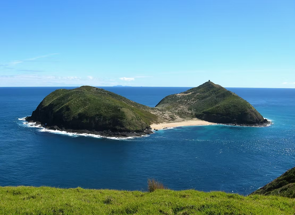
Pandora Beach – the name of a ship
On the other side of this territory lies Whangakea, also known as Pandora. It is a name that seems to have been lifted straight from mythology, perhaps even from the films of New Zealand’s most famous recent Kiwi filmmaker, James Cameron, director of the legendary Titanic and creator of the Avatar franchise, in which the planet is, coincidentally, called Pandora.
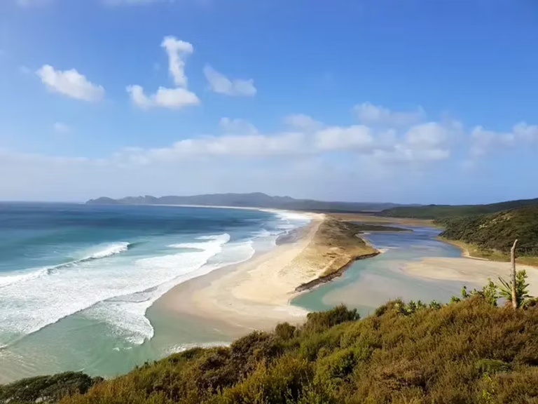
Its origin is much more concrete: the name recalls HMS Pandora, the ship that surveyed this coast in 1849. Here, the stories overlap fascinatingly. Māori have their own spiritual geography.

The Europeans came and drew another map: islands, bays, capes, ships, lighthouses. And we, today’s tourists, arrive with a third map—the map of photographs, roads, and Google Maps. Three different worlds looking at the same landscape.

Cape Maria van Diemen – the first edge of the European world
To the west lies Cape Maria van Diemen, one of the most spectacular points in the region. The name comes from the Dutch navigator Abel Tasman, who explored this coast in 1642 and named the cape in honour of the wife of the Governor-General of the Dutch East Indies.

Nearby lies Motuopao Island, the island where the first lighthouse at this farthest point of the country was built. Today, looking towards it, it is hard to imagine just how isolated this world once was. And it was precisely this isolation that would become the lighthouse’s main problem.

Tapotupotu Beach – a beach hidden among the rocks
On the opposite side, Tapotupotu Bay comes into view as a surprise. We head down towards the beach. It is one of those stops that make you forget you even have a destination. Pale sand, water, green hills, and forest descending almost to the shoreline. DOC (Department of Conservation) describes it as a place well suited to relaxing and camping, but warns that the sea can be challenging, with waves and strong currents.

This is also the right place to stop for a meal. Not at Cape Reinga. You do not eat there. It is not simply some arbitrary tourist rule, but part of respecting the sacred character of the place. DOC states that it is not culturally appropriate to eat at Te Rerenga Wairua; for a break and a meal, Tapotupotu is recommended. So we sit on the beach, eat something, and let the world carry on without us for a few minutes.
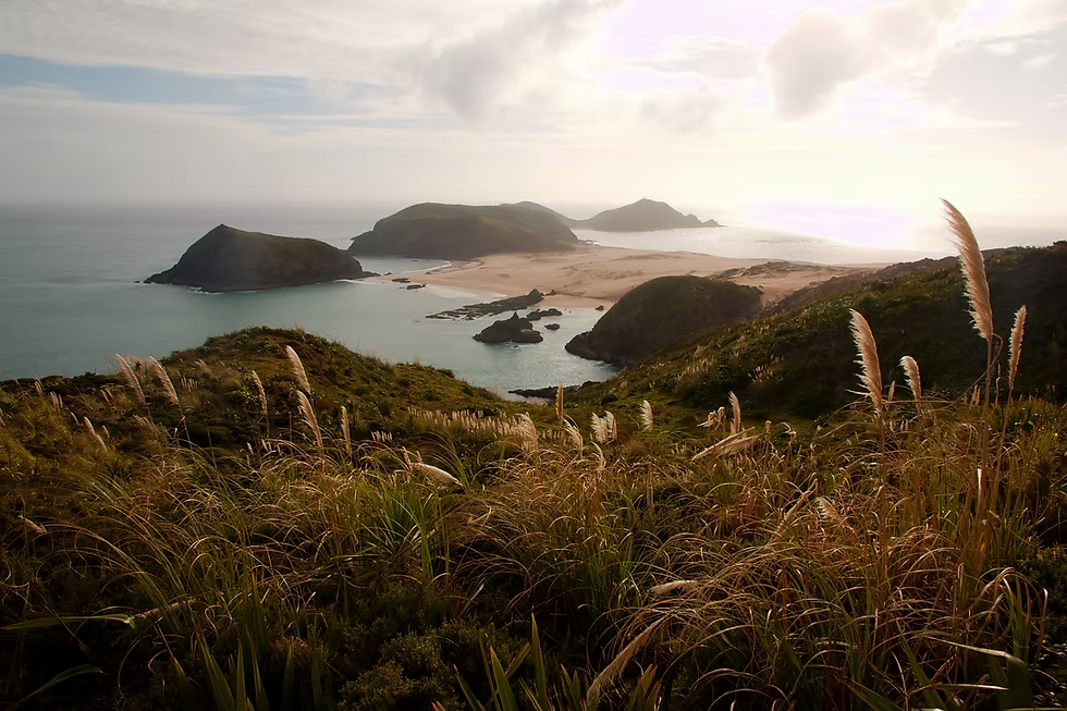
The Tree of Spirits
And then we reach the tree. The pōhutukawa at Te Rerenga Wairua. It is one of the best-known and most mysterious symbols of Cape Reinga. A twisted tree, battered by the wind, clinging to the edge of the cliff. It does not resemble the trees you see in a garden. It looks as though it has survived here against all the rules.
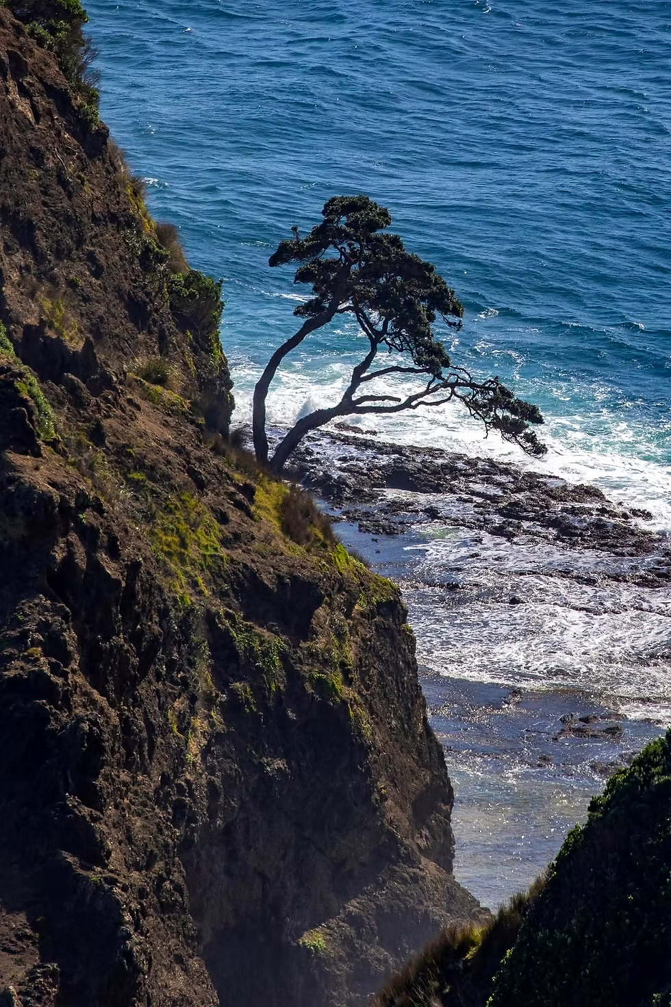
Tradition holds that this is the tree associated with the departure of the spirits. After reaching Te Rerenga Wairua, the spirit descends through the roots of the pōhutukawa into the sea, continuing its journey towards the world of the ancestors and Hawaiki.

The tree is believed to be around 800 years old. Historical sources even record a tradition that it has never flowered—a story that adds to its distinctive aura. Here, however, we need to distinguish between legend and botany.

We do not know whether a single tree can be traced continuously over eight centuries in the same way that we might precisely date a monument built by human hands. But what we do know is that the pōhutukawa at the edge of the cape is venerably old and of extraordinary cultural significance. For Māori, its value does not lie in a certificate of age. It lies in the story. In the fact that generations upon generations have looked at the same tree and said: "This is where the spirits pass".

The spirit descends through the roots of the tree and reaches the sea. But the journey does not end there. According to tradition, it travels towards Manawatāwhi/Three Kings Islands. There, the spirit emerges from the sea for one final look back at the land it has left behind, before continuing towards Hawaiki, the ancestral homeland. It is an extraordinary image. A person dies. But their story does not end in the grave. The journey continues. And it continues north.
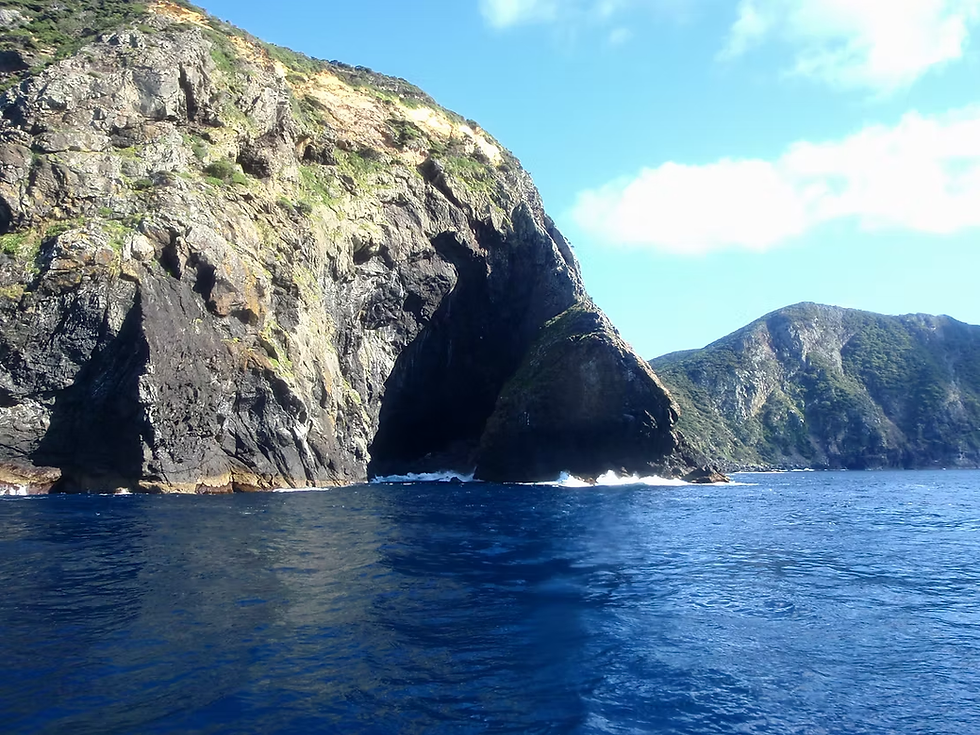
The Lighthouse That Came from an Island
Then, almost as a perfect counterpoint to the story of the spirit, the lighthouse appears. White. Small. Solitary. Modern compared with the legend it watches over. The first lighthouse in this region was not here.

In 1879, the authorities built the lighthouse on Motuopao Island, near Cape Maria van Diemen. The problem was that the island was extremely difficult to reach. The sea was rough, and keeping the lighthouse supplied became an adventure. In 1886, an ingenious flying fox system was built, an installation that allowed supplies and mail to be transported between the island and the mainland. In reality, people soon began using the system to cross as well. Entire families. Lighthouse keepers. People suspended above waters you did not really want to know too well. In 1933, the wife of an assistant lighthouse keeper was swept from the rocks by the waves. The incident contributed to the decision to move the lighthouse to the mainland, at Cape Reinga, where it could be accessed by land. In 1940, the old lighthouse at Cape Maria van Diemen was extinguished. The equipment was dismantled and transported to the new site. In 1941, the new Cape Reinga lighthouse began operating. It was the last major permanently staffed lighthouse built in New Zealand.
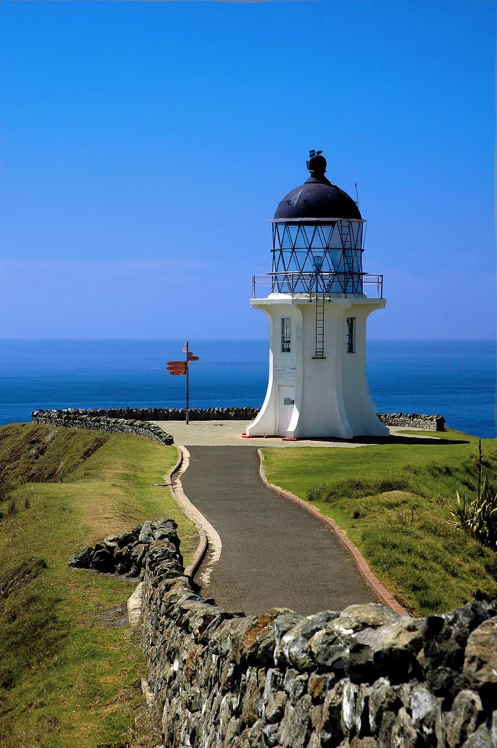
The Lighthouse in Wartime
There is also a lesser-known story. When the lighthouse began operating, the world was at war. In fact, its light was heavily affected by the blackout restrictions imposed during the early years. The lighthouse was no longer merely a navigational aid; in such an isolated corner of New Zealand, the war had reached even here. In 1918, before the new lighthouse was built, the German raider Wolf was spotted anchored nearby, in Twilight Bay. That same year, the Wimmera was sunk by a mine approximately 29 kilometres from the cape. Of the 151 people on board, 26 lost their lives. Another almost unbelievable episode: a mine washed ashore, and after it was spotted by the lighthouse keepers, it exploded before the army could intervene. The lighthouse, in this distant world, no longer seems romantic at all. It becomes what it has always been: an outpost between humanity and the sea.

The Last Manned Lighthouse
The lighthouse remained staffed until 1987, when it was automated and the last keeper left. Today, the light is powered by batteries charged by solar panels. In 2023, the system was upgraded with an LED beacon that flashes every 12 seconds and has a range of approximately 35 kilometres. It is an almost symbolic transformation. The human presence has disappeared from the lighthouse. The light remains. Just like the story. And then we look down. There it is, what we came here to see. The line between the Tasman Sea and the Pacific Ocean. It is not a line drawn with a ruler across the water. There is no solid boundary between the two seas. What we see is the result of the meeting of bodies of water, currents, and waves moving in different ways.

In the area of Columbia Bank, west of the cape, the currents of the Tasman Sea and the Pacific Ocean meet, creating at times a spectacular expanse of restless water, with foam and waves that seem to crash into one another. On certain days, the contrast is so visible that it looks as though someone has drawn a line across the ocean. One side. And the other.
West — the Tasman Sea.East — the Pacific. Two worlds of water meeting, without ever being truly separable.

And perhaps this is where the most beautiful metaphor of the entire journey lies. Because Māori tradition, too, speaks of this meeting of the waters in a language that goes beyond geography. Traditional cultural explanations associate the seas with identities and relationships that transform their meeting into an image of union, of forces coming together, and of life emerging from that encounter. We stand at the edge of the continent and look out. Behind us lie hundreds of kilometres of road. Paihia. Kerikeri. Mangonui. Cable Bay. Awanui. Pukenui. Te Kao. Waitiki. Before us are the oceans.

At the End of the Road
We begin this journey as ordinary people setting off from Auckland on a trip north. We have a car. A tank of fuel. A map. A few planned stops. And a destination. But the road slowly takes these things away from us. First, the noise of the city. Then the traffic. Then the shops. Then the crowds. And eventually, even the feeling that we need to hurry. At Waitiki, we left the last petrol station behind. At Ninety Mile Beach, we encountered the road of the spirits. At Spirits Bay, we stepped into legend. At Tapotupotu, we made our final stop. At the pōhutukawa, we encountered the story of death and the return to the ancestors. And at the lighthouse, we encountered the history of the people who tried to tame the sea. Now, at Te Rerenga Wairua, the two stories meet. Legend and history. Māori and European. Land and ocean. Life and death. And, in the distance, two seas that seem to push their waves against one another. Perhaps that is why this place does not feel like a destination. It feels like a passage. And we, after travelling hundreds of kilometres north, finally understand that we have not travelled to the end of the world. We have travelled to the edge of one world. Beyond it, another begins.
Beyond the End
Perhaps this is the beauty of a journey north. You leave Auckland believing that you are travelling towards the end of New Zealand. But when you arrive at Te Rerenga Wairua, you discover that there is no true ending. Only an edge. A place where the land gives way to the sea. A place where generations have stood beneath the same sky and looked towards the same horizon, seeing something larger than the landscape itself. And after you stay there long enough, something changes. The destination loses its importance. The kilometres become just numbers. The road, the car, the fuel stops, the timetable—all the practical things that seemed so important at the beginning—fade into the background. What remains is simpler: sky, ocean, land, and silence. We set off north thinking we were travelling towards a final point on the map. Somewhere along the way, the journey became something else. Not a search for an ending, but an encounter with the edge of what we know.
Epilogue
We stand there for a while without saying anything. The two seas stretch before us, restless beneath the changing light. The wind moves across the rocks and through the ancient pōhutukawa, carrying with it something that feels older than the road that brought us here.
There is nothing left to see after this. No further landmark to chase. No next stop that needs to be reached. And yet, it does not feel empty. Perhaps because Te Rerenga Wairua was never really about arriving. It was about what happens at the boundary: between land and sea, between the living and the ancestors, between the world we know and whatever lies beyond it. We remain there for a few moments, saying nothing. Then we turn back. The road is still there.


Comments